Advertisement
Commentary
How to hike through 25 miles of green space in Boston
Resume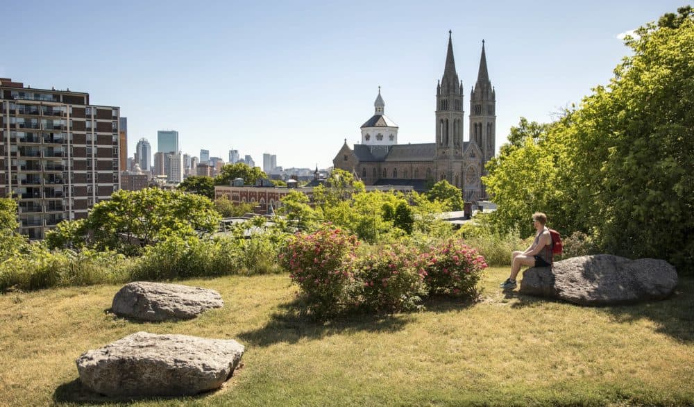
One long frozen night in December of 2020 — our first COVID winter — I threw some mixed nuts in a backpack, pulled on my thermal boots and trekked from Jamaica Plain to the summit of Fort Hill. I wanted to see the eerie hilltop tower (of the same name) that looms over Roxbury, and taking walks across Boston had become my tonic for pandemic stress. But this was more than a walk. By the time I reached the base of the tower, I was sweating through my thermal layers, huffing and struggling to catch my breath after the final push up the hill. And I still had the return journey ahead of me.
All of which got me thinking: Can you go hiking in the middle of a city?
Hiking is something we associate with the backcountry, as evidenced by crowded trailheads and the endless lines of cars parked along roads that we’ve seen over the last few years, as more people rush to the outdoors for an escape from the rigors of the 2020s. But if “hiking” involves a foot journey from point A to point B, with scenic stops along the way, then surely a cityscape rustling with parks and teeming with historic oddities would qualify as a hiking venue, right?
That’s what several residents of San Francisco were thinking when they scouted and mapped the 17-mile Crosstown Trail. An epic hiking route through the city’s best parks and rustic green spaces, the Crosstown Trail is comprised of pre-existing green space paths and thoughtfully chosen street walks through residential neighborhoods. It’s not physically marked, but digital maps and directions show you the way.
After reading about the Crosstown Trail in National Geographic, I got myself to the Bay Area and hiked the trail over two days. As I boarded the plane back home, I realized that Boston could host a long-distance hiking trail of its own.
Boston is home to an enviable wealth of recreational zones -- many of which are interconnected.
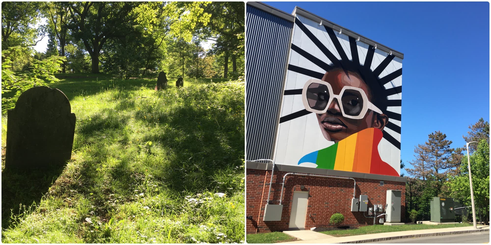
Often called “America’s Walking City,” Boston is a fantastic place for being a pedestrian. There’s almost always sidewalk on which to wander, and then there are Boston’s green spaces. From manicured parks like Boston Public Garden and Arnold Arboretum to the shaggier urban forests such as Stony Brook Reservation and Sherrin Woods, Boston is home to an enviable wealth of recreational zones — many of which are interconnected. Frederick Law Olmsted’s Emerald Necklace linear park system, which stretches over seven miles from Franklin Park to Boston Common, is arguably one of the oldest urban hiking trails in America. Between this greenway and the Freedom Trail — a historic hike — Boston has experimented with the concept of urban hiking for over a century.
So, I decided to add a new trail to our lineup: the Walking City Trail.
As this winter faded to early spring blooms, I spent my evenings studying maps of Boston parks and urban wilds, leveraging tools like Google Earth and AllTrails (the app) to identify little-known pathways that could connect established green spaces. The underlying theme of the trail would be immersion. I wanted to guide people through the urban green spaces that are lush and wild enough to make you forget that you’re in the middle of a city.
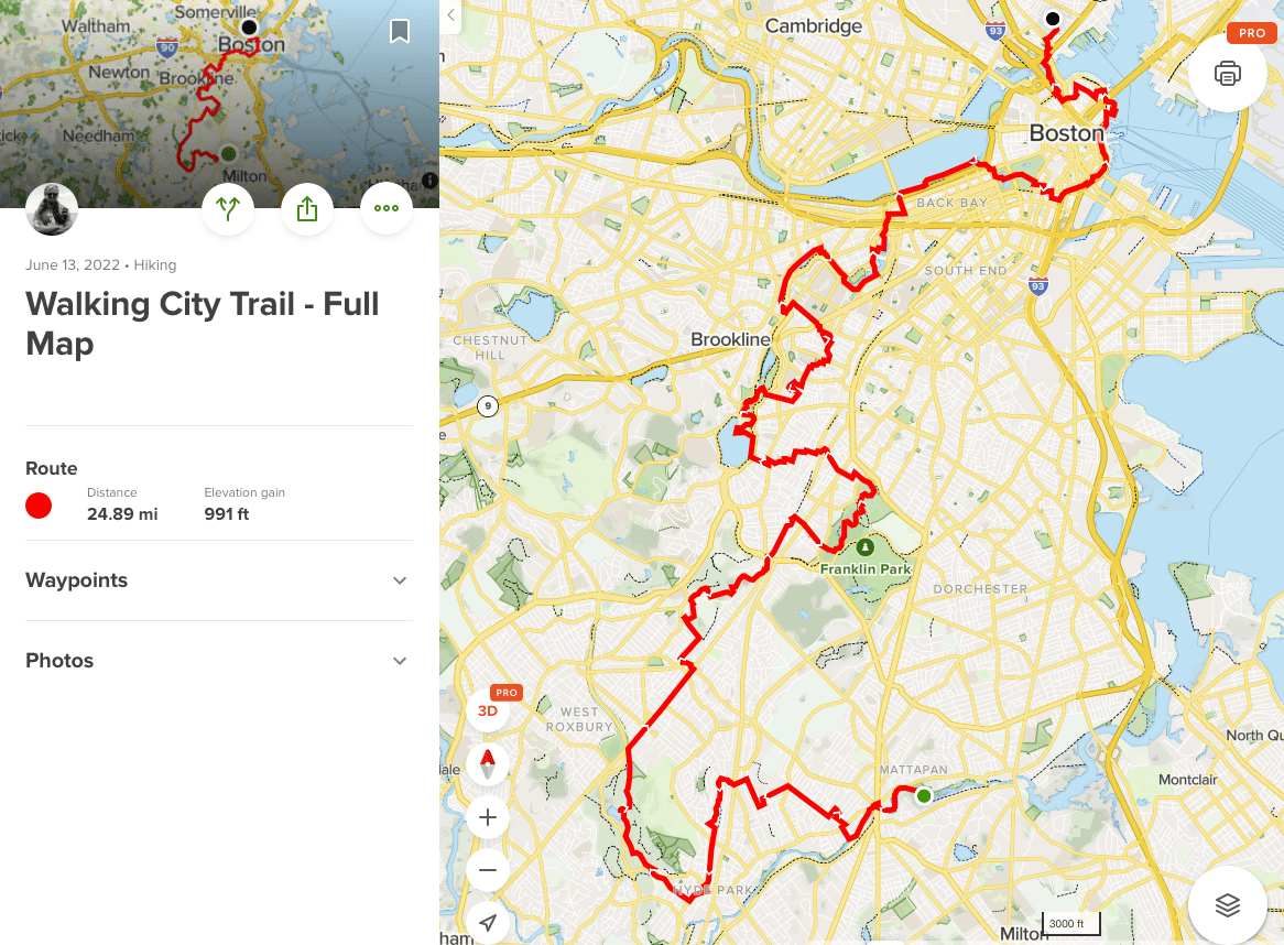
Slowly, a 25 mile-hiking route started to crystalize. It begins at the Harvest River Bridge on the Neponset River Greenway, where you can cross into Boston from Milton. The final climb leads hikers to the base of Bunker Hill Monument.
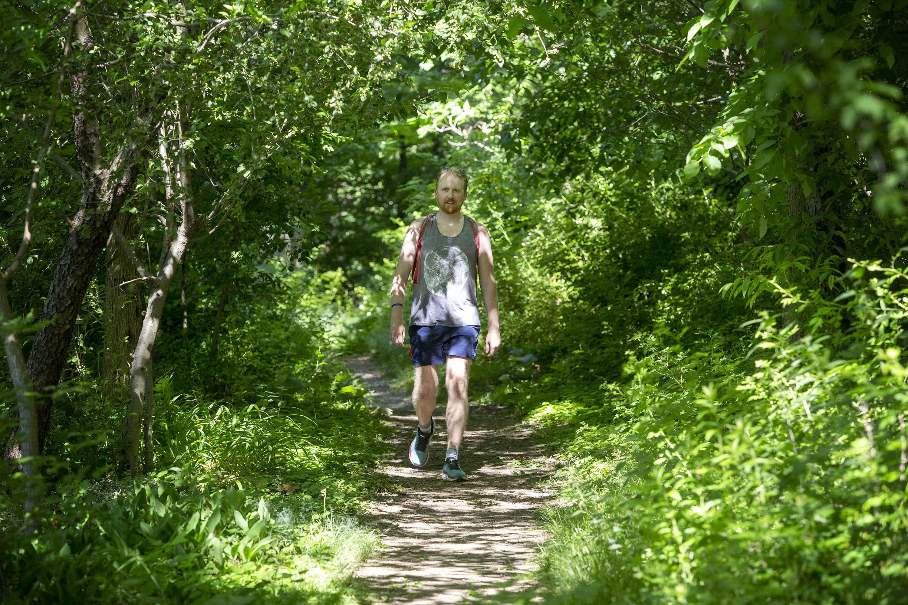
With my idea of the trail map in place, it was time to hike. With the afternoons warming up and the brown earth becoming more fragrant, I set off to walk the entire thing and compare my mapping with the reality on the ground.
I wanted to guide people through the urban green spaces that are lush and wild enough to make you forget that you’re in the middle of a city.
The trick of designing an urban hiking trail is finding the most interesting features through which you can route the trail. I looked for staircases, railroad overpasses, tunnels and other passages that could break up the familiarity of dirt trails and sidewalks. I divided the trail into four sections that hikers could choose to explore in pieces, over a weekend, or from dawn to dusk over the course of one grueling day. Wherever possible, I took note of trailside restaurants, bathrooms, and public transit stops where hikers could board a bus or train to return to their point of origin.
This last part was very important. One of the most compelling perks of urban hiking is the ease of access. Most backcountry hiking requires access to a vehicle — a financial and logistical barrier for many of us. But to hike the Walking City Trail, all you need to do is walk out your door, jump on the nearest Boston-bound bus or train, and pick up the trail from whatever entry point you choose. Free trail maps and directions — available at the trail website, BostonTrails.org — are the only navigational tools required to complete the hike.
What I hope that people who hike the Walking City Trail will take away from their journey is the notion that hiking can happen anywhere. It’s not the sport of elite, rugged individualism that magazine stories about mountain climbing might lead you to assume.
When we approach hiking and trail design with the right balance of abstract thinking and sensitivity to barriers of access that have historically prevented many hikers from hitting the trails, hiking can evolve and grow. New trails can take root in unlikely environments, feeding the growing demand for hiking venues. People who use these trails will cross paths, and from there, who knows what else might take root?
Jerry Garcia sang decades ago: “what a long strange trip it’s been.” But as the last few years have shown us, life can also be fleeting. It’s something to be poked around, savored, and shared with others.
So this summer and beyond, try exploring a side of Boston that you’ve never experienced before. Hike the Walking City Trail.
This piece was produced by Cloe Axelson, with help from David Greene and Paul Calo.