Advertisement
Forecast: Showers And Thunderstorms Tuesday Afternoon
UPDATE --
The National Weather Service in Taunton has issued a severe thunderstorm watch for Suffolk County and other locations in Massachusetts that will be in place until 7 p.m. Tuesday. A severe flood watch is also now in place for the Greater Boston area and elsewhere until 10 p.m. Tuesday.
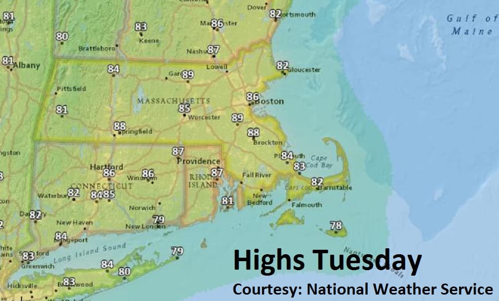
A very humid, tropical air mass will be in place through today. With highs in the 80s and dew points in the low 70s, it will feel pretty uncomfortable. A rather strong front will push through this afternoon and evening producing showers and thunderstorms.
Some of the storms will have heavy rain, strong gusty winds and dangerous lightning.
There will be a few leftover showers tonight into early Wednesday. As a more northwesterly wind kicks in, the humidity will be noticeably lower for the remainder of the week.
Plenty of sunshine will be the rule into the weekend with temperatures near or slightly below normal along with comfortable humidity.
The mugginess will begin to edge back in again Saturday night with the potential for showers Sunday into the first part of next week.
Tuesday: Partly sunny, warm, quite humid. Thunderstorms may bring heavy rain and gusty winds. High 86.
Tuesday Night: Cloudy, few leftover showers. Lows near 70.
Wednesday: Early clouds, then becoming mostly sunny. Turning less humid. High near 80.
Thursday and Friday: Mostly sunny and dry. Highs upper 70s and low 80s.
This article was originally published on July 17, 2018.