Advertisement
Snow arrives this afternoon, ahead of warmer weather
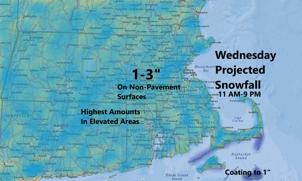
A storm system passing south of New England will bring an area of rain and snow later Wednesday into the early evening.
Most of the region will mostly see snow and even if there's a little bit of rain to start, it should change over as colder air arrives from above.
March snows are different than the ones in the colder months. There's residual heat in the asphalt so the amount that accumulates on roads is usually less than you would find on your car top or the grassy surfaces.
Generally, I'm expecting 1 to 3 inches of snow across the area. It's possible that some areas with higher elevations see 4 inches. The snow will be somewhat heavy and wet, which can always lead to a few crushed plants, but I don't expect this to be widespread.
The snow will come to an end between 7 and 9 p.m., from west to east, and then we will see some clearing. Temperatures overnight will fall below freezing, meaning any residual moisture will freeze, creating the possibility of some ice early Thursday.
Sunshine returns Thursday and Friday, with afternoon temperatures reaching near 50 on Thursday and a degree or two above by Friday. The snow should quickly disappear by Thursday afternoon.
A new storm will arrive to start the weekend. Rain will arrive Saturday morning and come to an end before sunrise Sunday.
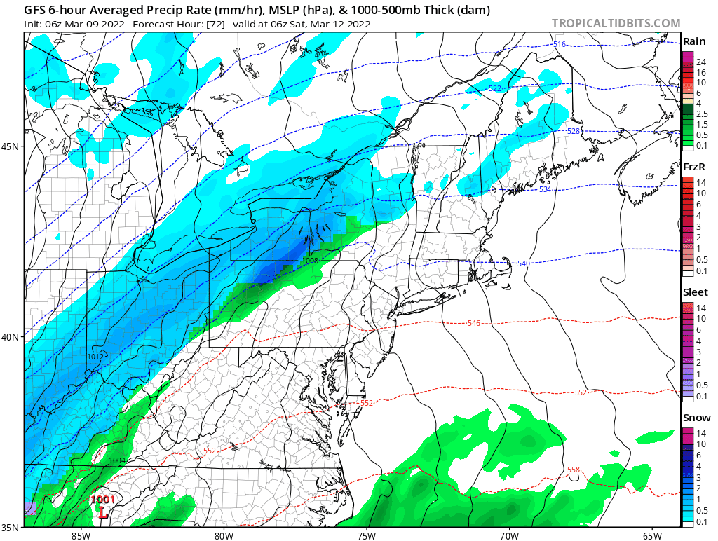
As cold air works into the region, the rain may end as a brief period of snow with a blustery wind. Temperatures will be cold on Sunday staying in the 30s, but feeling more like the teens and 20s.
