Advertisement
Fire danger and low overnight temps expected as cold, dry air moves in
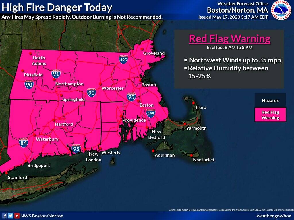
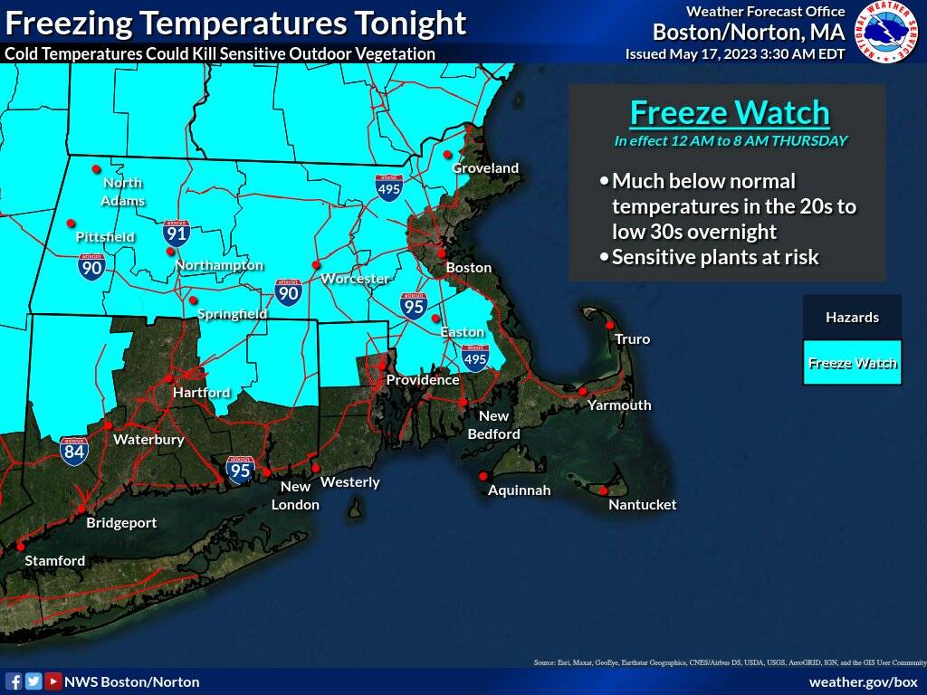
There is a higher risk of fires and below-normal temperatures as an extremely dry air mass moves into Massachusetts on Wednesday, according to The National Weather Service. The conditions have prompted the NWS to issue both a red flag warning for most of the state and a freeze watch for western Massachusetts.
The red flag warning goes into effect at 8 a.m. Wednesday and will last until 8 p.m. The warning does not include the Cape and Islands.
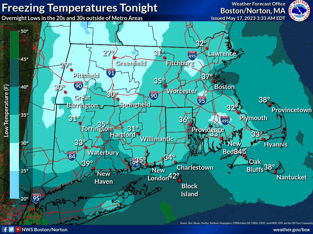
The freeze watch is scheduled to begin at midnight and will last until 8 a.m. Thursday Overnight, temperatures are expected to dip into the mid-20s to low-30s for more outlying places. Temperatures in Boston and other urban centers will be in the mid-30s.
"Avoid outdoor burning and if you have sensitive outdoor vegetation, you may want to consider bringing plants inside!" read the NWS announcement.
The region has experienced dry weather for several days. A red flag warning was also in effect Tuesday. Also, since Friday, a brush fire has been burning at Lynn Woods, causing some trails north of Walden Pond to close, though fire officials say the fire has been contained.