Advertisement
A blustery storm will complicate travel ahead of Thanksgiving
A storm center pushing out of the Great Lakes will bring a tough round of weather through much of the Eastern U.S. ahead of Thanksgiving Day. The bad weather will stretch all the way down to Florida, but for New England, expect steady and at times heavy rain is likely for most, though a few interior locations may receive their first snow of the season.
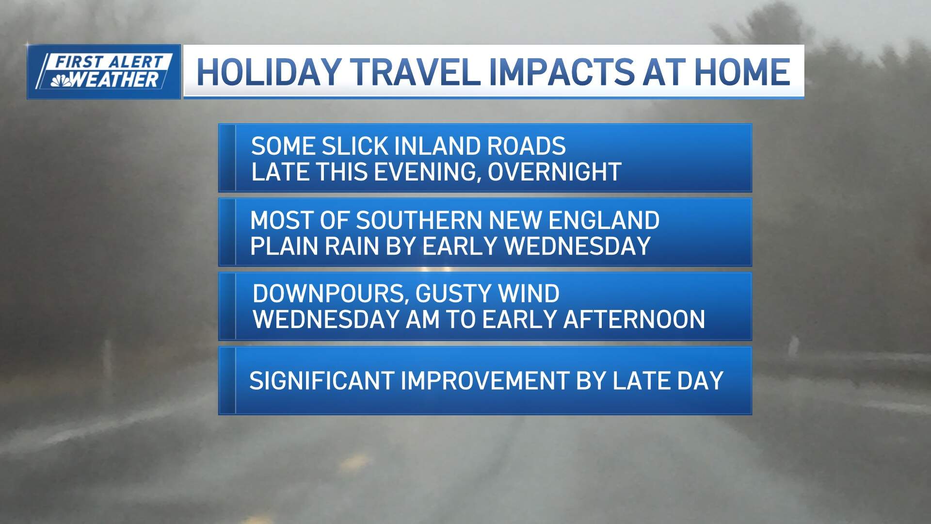
The storm will impact travel as early as Tuesday night. Light-to-moderate rain will spread from west to east across the region between 7 p.m. and 10 p.m. Along the warm front, pockets of showers will pop up across the Mass. Pike and along Route 2.
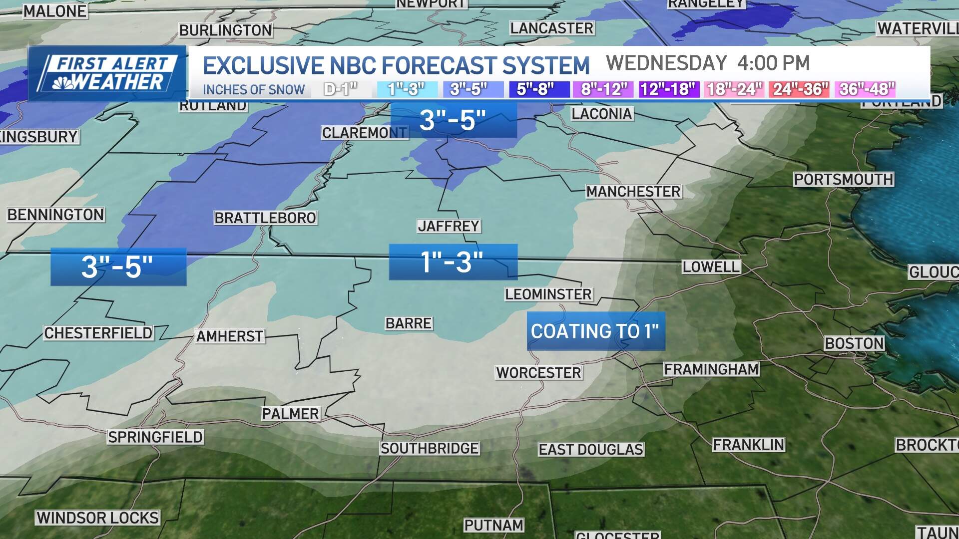
To the west, and in elevations above 1,000 feet especially, snow will mix with sleet from the Worcester Hills, and through the Monadnocks between Jaffrey and Keene, New Hampshire, beginning around 9 p.m. Tuesday night, lingering until the early hours of Wednesday. Most snow totals will be minimal (between 1-3 inches) given the heavier rain and warm air that shortly follows.
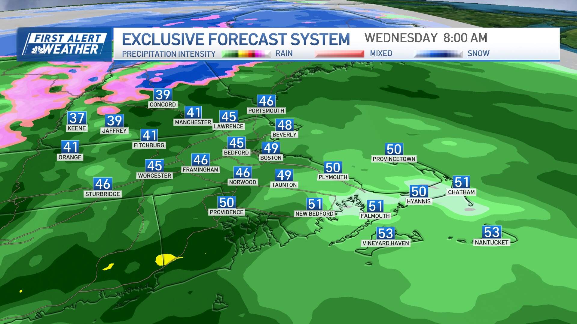
Temperatures will warm into the upper 30s to low 40s on Wednesday morning, with some heavy rain in places. Southeast Massachusetts will actually rise briefly into the 50s as low pressure tracks overhead.
The steadiest rain should wrap up around midday Wednesday, though a few lingering showers are possible in the afternoon. Rainfall totals will generally run half an inch to an inch, with some locally higher amounts.
For those traveling Tuesday night or Wednesday, it's worth leaving plenty of extra time to get to your destination. You can expect reduced visibility, road spray and puddles on the drive, so take it slow and leave plenty of space between you and the car in front of you.
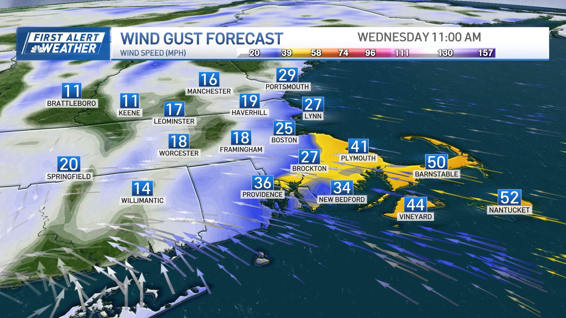
The wind will be a concern for Cape Ann, Cape Cod and the Islands, where a wind advisory is in effect from 4 a.m. through 4 p.m. Wednesday. Southeast gusts of 45 to 55 mph in these areas will result in pockets of damage and outages, especially midday. An isolated gust to 60 mph can't be ruled out.
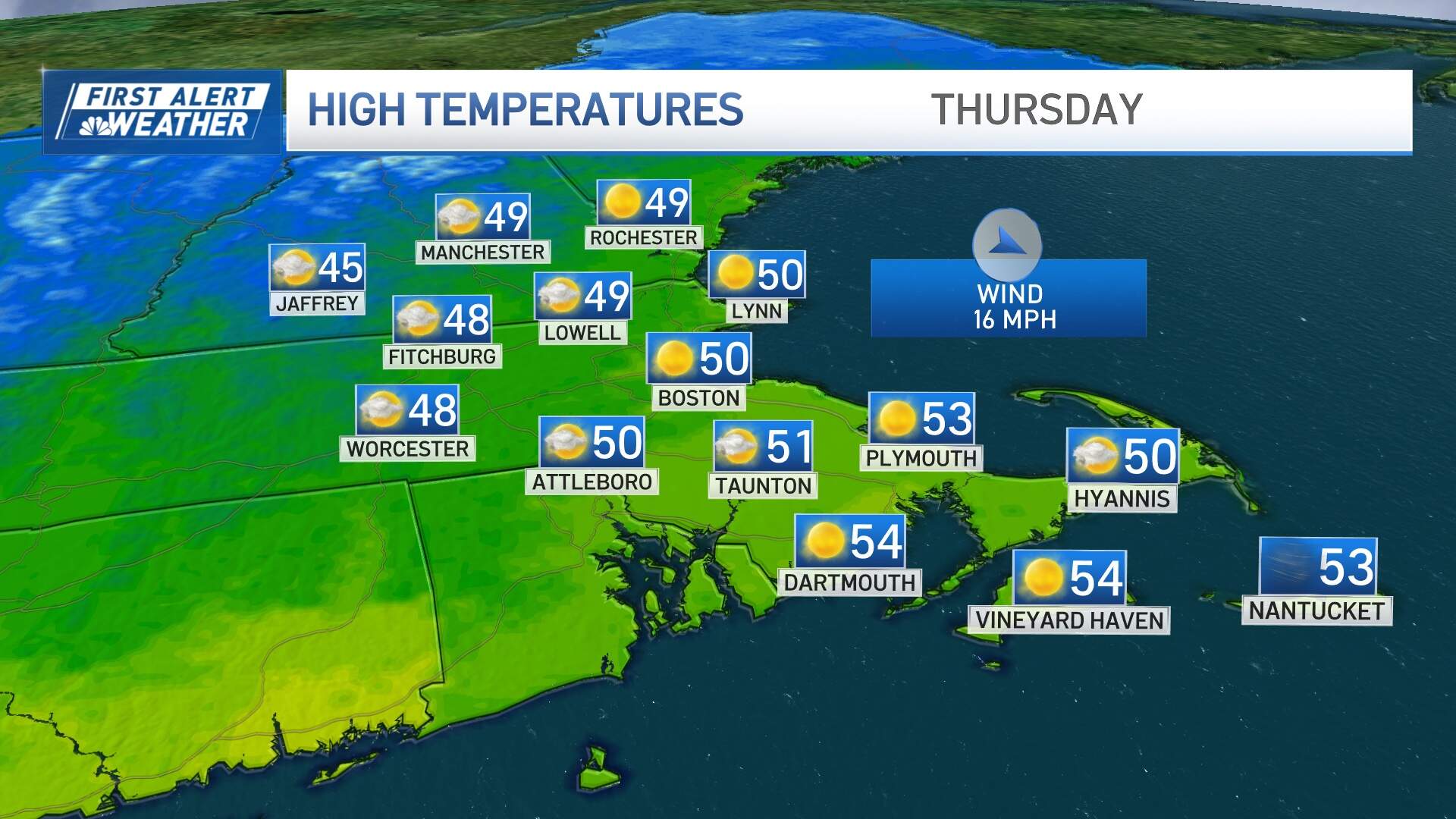
Behind the system, the wind will shift to blow out of the northwest Wednesday evening, drying us out. That means Thanksgiving Day will be a much quieter day overall, with sunshine returning and seasonable temperatures around 50 degrees. The northwest wind won't be damaging, though gusts 20 to 30 mph will mean a brisk feeling day overall.
For morning Turkey Trots and football games, the temperature will be in the upper 30s for many, with a wind chill about 5-10 degrees colder.
Friday will be a cool and quiet day too, with highs in the low to mid 40s.
Saturday is going to be cold. In fact, high temperatures won't get out of the 30s for most cities and towns despite lots of sunshine. Clouds increase late Saturday, ensuring a mostly cloudy day on Sunday. It won't be as cold: highs will top out in the low 40s.
Both days look dry with showers returning late Sunday, likely in the evening hours.